


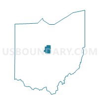
CHESTER TWP WEST, Morrow County, Ohio
About
Outline

Summary
| Unique Area Identifier | 650713 |
| Name | CHESTER TWP WEST |
| County | Morrow County |
| State | Ohio |
| Area (square miles) | 11.90 |
| Land Area (square miles) | 11.85 |
| Water Area (square miles) | 0.04 |
| % of Land Area | 99.63 |
| % of Water Area | 0.37 |
| Latitude of the Internal Point | 40.46526800 |
| Longtitude of the Internal Point | -82.70912890 |
Maps


Graphs
Select a template below for downloading or customizing gragh for CHESTER TWP WEST, Morrow County, Ohio


Neighbors
Neighoring Voting District (by Name) Neighboring Voting District on the Map
- BENNINGTON TWP EAST, Morrow County, OH
- CHESTER TWP EAST, Morrow County, OH
- FRANKLIN TWP, Morrow County, OH
- HARMONY TWP N, Morrow County, OH
- HARMONY TWP S, Morrow County, OH
- S BLOOMFIELD TWP E, Morrow County, OH
- S BLOOMFIELD TWP W, Morrow County, OH
Top 10 Neighboring County Subdivision (by Population) Neighboring County Subdivision on the Map
- Bennington township, Morrow County, OH (3,102)
- Harmony township, Morrow County, OH (2,626)
- Chester township, Morrow County, OH (1,872)
- South Bloomfield township, Morrow County, OH (1,752)
- Franklin township, Morrow County, OH (1,617)